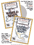
Olde World Style Modern and Ancient Maps: World Maps
Old World Style Modern and Historical Maps: United States Maps
Published at
Home School In The Woods
This is my first review on the second year of the TOS Homeschool Crew. I got asked back in February to join the team again and gladly accepted. It has been a hard year in 2009 (as it was for many I am sure) but to be asked to come aboard the Crew was a blessing for our family. So when I received my first products to review from
Home School In The Woods, I quickly look at it.
My first impression was to be overwhelmed with emotions as I discovered the Olde World Style Modern and Ancient Maps for the World and for the United States. And honestly, I am still speechless and in awe every time I open the files.
The details in these maps are absolutely stunning. The folks at Home School In The Woods have taken the time to create a quality product to help you teach geography. The first map I printed was CANADA obviously and my son who is 9 was all excited to practice learning the provinces and territories of our country. He even did more than I asked him to do and learned the countries surrounding Canada, seas, bays and rivers on the map as well.
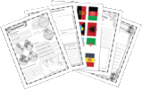
I was even more impressed with the products when I realized that you could also get some interesting pages related to the theme of the products. For example, in the Old World Style Modern and Ancient Maps: World Maps you would find recipe cards, flags, special identification graphics for the countries, geography terminology to learn, Flora and Fauna, History timeline and so much more! You will also get the maps from ancient Egypt, ancient Greece, the voyages of Paul, Palestine time when Jesus came, and so on.

However, in the Old World Style Modern and Historical Maps: United States you will be able to get the State Facts pages to write down information about all the various states. This would be very fun to do when we go on a trip in the US with our RV. Two years ago, we went to PA, MA, ME before heading to NB and PE in Canada. Consequently, I am thinking of starting a project with my oldest son so he can keep track which states we have visited so far in a notebook. Theses pages are simply wonderful! This product is a wonderful addition for our
Little Man in The Maps that I reviewed previously.
My only regret is that there isn’t pages for the different provinces and territories of Canada like the ones for the various states in the US. I personally think it would be a great addition. Why not create an Olde Word Style Modern and Historical Maps: CANADA. After all we have a lot of history in our land and to think that Nunavut is a territory only since 1999. It would be very interesting to have the progression of Canada on maps with this concept. And we could include pages for Canadian recipes from natives as well as French Canadians and immigrants in the country. Don’t you think it would be a great idea? And with the number of homeschoolers in Canada, I am sure that this would be a product that will be popular among us Canadians.
In conclusion, I absolutely recommend these products for anyone who want to discover geography with their children. They are well done and fun to use. I know that these products will be used a lot in our household and in our trips. The world is right at our fingertips!
Downloads are priced at 18.95$ each, and the CD version is 19.95$ each. They also have a COMBO-PACK (both sets together) priced at 28,95$ for the download and 29.95$ for the CD set. The
Old World Style Maps are available direclty from Home School In the Woods.

No comments:
Post a Comment